
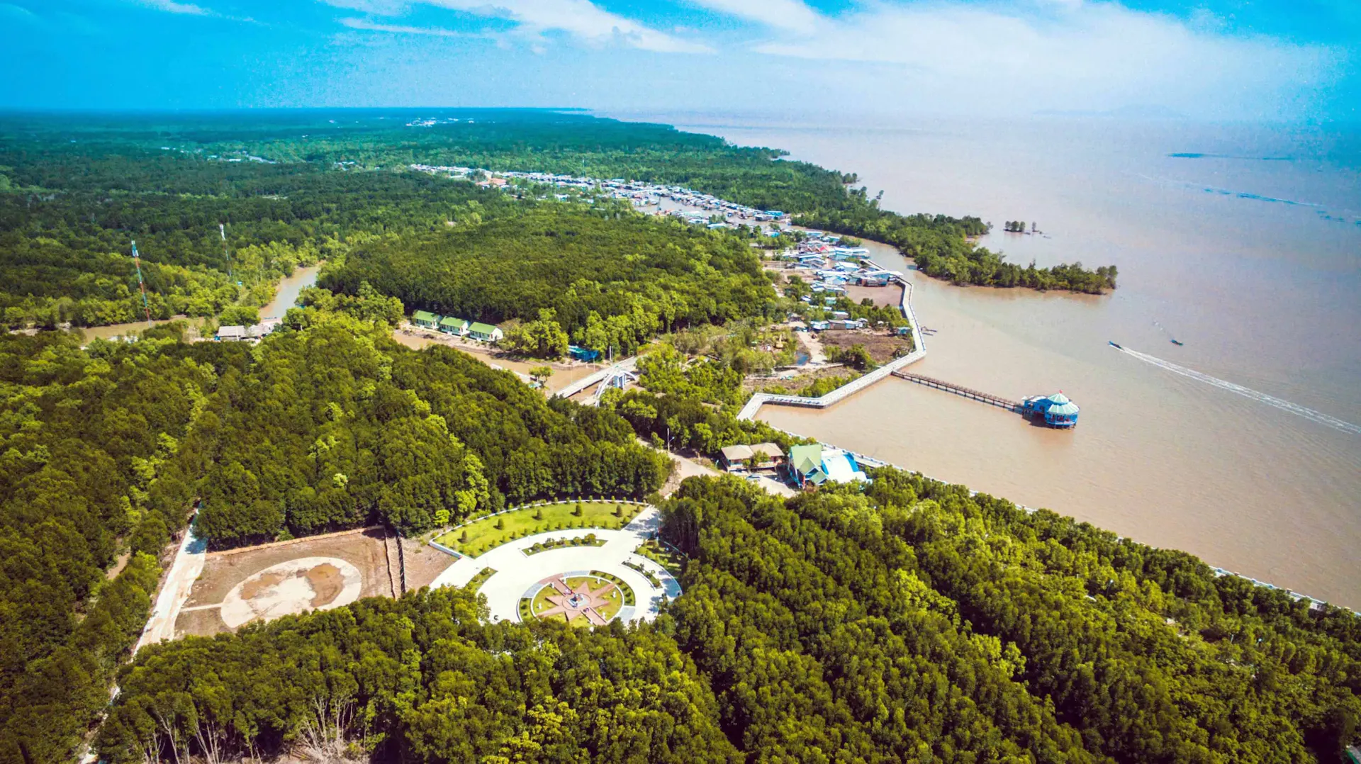
Dat Mui National Park
Dat Mui National Park is one of Vietnam's most remarkable protected areas, located at the country's southernmost tip in Ca Mau Province. Famous for its vast mangrove forests, rich biodiversity, coastal wetlands, and the iconic Cape Ca Mau landmark, the park offers unforgettable ecotourism experiences. Visitors can explore winding waterways, observe rare wildlife, discover UNESCO-recognized biosphere reserves, and stand at the symbolic southern end of Vietnam. This guide covers everything you need to know before visiting Dat Mui National Park.

About Dat Mui National Park
Dat Mui National Park is a remarkable coastal destination at the southernmost tip of Vietnam, located in Ca Mau Province. Known for its mangrove forests, tidal waterways, mudflats, and diverse coastal ecosystem, the park offers travelers a chance to experience one of Vietnam's most distinctive natural landscapes.
Located within the Ca Mau Cape area, Dat Mui is where several waterways and coastal environments meet. The landscape is shaped by tides, sediment, and mangrove vegetation, creating an ever-changing environment that is closely connected to the life of local fishing communities.
What Is Dat Mui National Park?
Dat Mui is part of the protected natural landscape around Mui Ca Mau, Vietnam's southernmost point on the mainland.
The area is dominated by mangrove forests, tidal channels, coastal mudflats, and wetlands.
Unlike traditional inland forests, mangroves grow in an environment influenced by seawater and changing tides.
This creates a unique ecosystem that supports numerous species of fish, birds, crabs, shrimp, and other coastal wildlife.
The Mangrove Forest
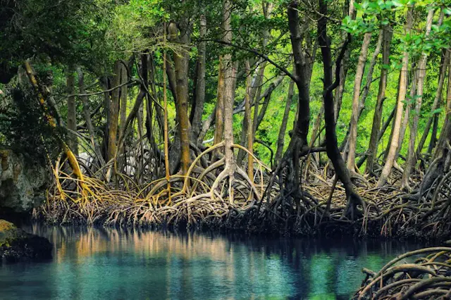
Mangroves are the defining feature of Dat Mui.
Their complex root systems help stabilize the coastline by trapping sediment and reducing erosion.
The forests also provide important nursery habitats for marine species.
As the tides rise and fall, parts of the mangrove landscape can appear dramatically different.
Travelers may see exposed mudflats at low tide and waterways surrounded by water at high tide.
Vietnam's Southernmost Landscape
One of the main attractions of Dat Mui is its location at the southernmost tip of mainland Vietnam.
The area has become an important destination for travelers who want to visit the country's southernmost point and experience the surrounding coastal environment.
The Mui Ca Mau National Park landscape represents the meeting of land, rivers, and sea at the edge of the Mekong Delta.
This geographical setting gives Dat Mui a distinctive identity among Vietnam's nature destinations.
Cape Ca Mau
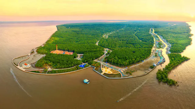
Cape Ca Mau, or Mui Ca Mau, is the geographical highlight of the area.
The cape is surrounded by coastal wetlands and mangrove forests and has become an important symbol of Vietnam's southernmost territory.
Visitors can explore designated viewpoints and landmarks in the area while learning about the geography and natural environment of the cape.
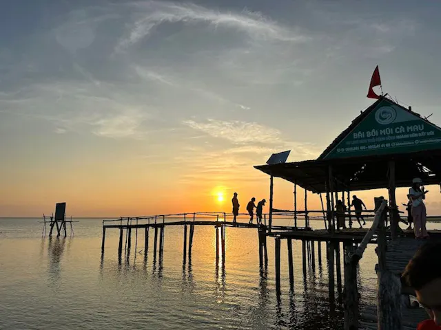
The landscape is particularly impressive at sunrise and sunset, when the coastal scenery takes on warmer colors.
Wildlife and Birdlife
The mangrove ecosystem provides habitat for a wide variety of wildlife.
Birds are among the most visible animals, with wetland species using the forest and mudflats for feeding and nesting.
The tidal environment also supports crabs, shrimp, fish, mollusks, reptiles, and numerous smaller organisms.
Wildlife sightings vary according to season, tides, and weather.
Visitors should observe animals from a respectful distance and avoid disturbing nesting or feeding areas.
Exploring the Waterways
Boat trips are one of the best ways to experience Dat Mui's coastal environment.
Local boats can travel through narrow waterways surrounded by mangroves, offering views that are difficult to appreciate from land.
The movement of the tides creates changing scenery throughout the day.
Travelers should follow local guidance regarding boat routes, safety equipment, and weather conditions.
The Mekong Delta Coast
Dat Mui demonstrates how dramatically the Mekong Delta changes as it reaches the sea.
The region is shaped by enormous quantities of sediment carried downstream by the Mekong River.
Mangroves trap some of this sediment, contributing to the gradual formation and stabilization of coastal land.
The interaction between freshwater, seawater, tides, and sediment has created one of Vietnam's most important coastal ecosystems.
Local Fishing Culture
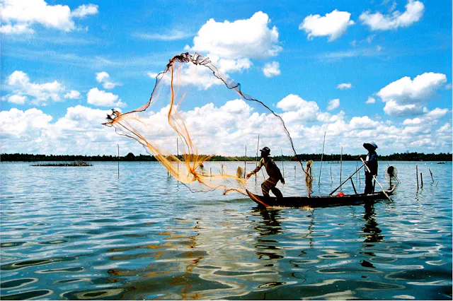
Life around Dat Mui is closely connected to the sea and waterways.
Local communities have traditionally relied on fishing, aquaculture, crabs, shrimp, and other coastal resources.
Visitors may see fishing boats, aquaculture ponds, small riverside settlements, and seafood-processing activities in the surrounding area.
Fresh seafood is an important part of the local food culture.
Local Seafood
Travelers visiting Dat Mui can sample a variety of southern Vietnamese seafood.
Depending on the season, local restaurants may serve crab, shrimp, mudskippers, oysters, clams, fish, and other coastal specialties.
The region's seafood reflects the unique environment of the mangrove wetlands.
For visitors interested in food culture, enjoying a local seafood meal adds another dimension to a trip to Vietnam's southernmost region.
Best Time to Visit Dat Mui
Dat Mui can be visited throughout the year, but weather and tidal conditions should be considered when planning outdoor activities.
The dry season from around December to April generally provides more favorable conditions for road travel and sightseeing.
The rainy season can bring heavier rainfall and stronger winds.
Because the landscape is strongly influenced by tides, travelers planning boat trips should also check local tide and weather conditions.
How to Get to Dat Mui
Dat Mui is located in the southern part of Ca Mau Province.
Travelers typically travel through Ca Mau City before continuing south toward the cape.
The journey can be made by private vehicle, taxi, motorcycle, or organized tour.
Because the area is relatively remote, arranging transportation in advance is recommended, particularly for travelers planning to explore several attractions in the region.
Things to Do in Dat Mui
Visitors can explore mangrove forests, take boat trips through tidal waterways, photograph the coastal landscape, visit viewpoints, and learn about local fishing communities.
Walking along designated paths and observation areas provides another way to experience the environment.
Travelers interested in geography and nature can also learn about the processes that have shaped the southern tip of the Mekong Delta.
Responsible Travel
Dat Mui is a sensitive coastal ecosystem, making responsible tourism particularly important.
Visitors should remain on designated routes, avoid littering, refrain from disturbing wildlife, and follow local conservation rules.
Mangroves are essential to coastal biodiversity and shoreline protection, so travelers should avoid damaging trees, roots, or young plants.
Supporting local guides and community-based tourism can also help contribute to the sustainable development of the area.
Why Visit Dat Mui National Park?
Dat Mui offers travelers a unique opportunity to experience Vietnam's southernmost coastal landscape, mangrove forests, tidal waterways, wildlife, and fishing culture.
Its remote location and distinctive ecosystem make it very different from Vietnam's better-known beaches, mountains, and urban attractions.
For travelers seeking an off-the-beaten-path adventure, Dat Mui provides a memorable way to discover the natural character of Ca Mau and understand how the Mekong Delta meets the sea at the southern edge of Vietnam.
Dat Mui National Park Photo Gallery
Browse our collection of photographs showcasing the breathtaking landscapes of Dat Mui National Park. Discover vast mangrove forests, winding waterways, diverse wildlife, panoramic coastal views, the iconic Cape Ca Mau landmark, peaceful boardwalks, observation towers, and the unique natural beauty found at Vietnam's southernmost national park.
How To Get There Dat Mui National Park
Bus and coach
Regular long-distance coaches connect Ho Chi Minh City with Ca Mau City, the nearest major transport hub to Dat Mui National Park. From Ca Mau City, visitors can continue by local bus, shuttle, taxi, or private vehicle to Dat Mui Commune, followed by short local transfers to the park entrance or Cape Ca Mau Tourist Area.
Train
There is no railway service to Ca Mau Province. Travelers arriving by train can take a train to Ho Chi Minh City and continue the journey to Ca Mau by coach or domestic flight.
Driving
Driving is one of the most convenient ways to explore the region. From Ho Chi Minh City, the journey follows National Highway 1A through the Mekong Delta to Ca Mau before continuing south via provincial roads toward Ngoc Hien District and Dat Mui Commune. The drive typically takes 8–10 hours, depending on traffic.
Flying
The fastest option is to fly from Ho Chi Minh City to Ca Mau Airport, with direct domestic flights operated several times each week. From the airport, travelers can reach Dat Mui National Park in approximately 2–3 hours by road.
Frequently Asked Questions About Dat Mui National Park
What is Dat Mui National Park famous for?
Dat Mui National Park is famous for its vast mangrove forests, rich biodiversity, coastal wetlands, and its location at Vietnam's southernmost point. It is part of the UNESCO-recognized Ca Mau Cape Biosphere Reserve and is one of the country's most important ecological areas.
What can I do at Dat Mui National Park?
Visitors can take boat tours through mangrove forests, walk along elevated boardwalks, climb observation towers, enjoy birdwatching, photograph stunning coastal landscapes, visit the Cape Ca Mau landmark, and experience local fishing communities.
When is the best time to visit Dat Mui National Park?
The dry season, from December to April, offers the most pleasant weather for sightseeing, boat trips, and wildlife observation. The rainy season provides lush scenery but may bring occasional heavy showers.
How do I get to Dat Mui National Park?
The easiest way is to travel to Ca Mau City by flight or coach, then continue by car, taxi, or local transport to Dat Mui Commune. Many visitors also join guided tours that include transportation and boat excursions
Is Dat Mui National Park suitable for families?
Yes. The park is suitable for families, nature lovers, photographers, and birdwatchers. Boardwalks, viewing platforms, boat tours, and the nearby Cape Ca Mau Tourist Area provide enjoyable experiences for visitors of all ages.
Advertising box